I’m rewriting a post that I wrote a few years back. I was short on time when I wrote the original, so I thought I needed to give the subject more attention. So, here goes…

I have written about Mosier, and Maryhill previously, and I have mentioned a weather phenomenon called the “rainshadow.” It seems that greater detail is deserved.
The rainshadow is a climate effect created by the Cascade Mountains. The Ring of Fire extends through the Pacific Northwest, and has, over the millennia, pimpled the landscape with volcanoes and high ridges that interplay with western Oregon’s fabled cloud cover, wringing the moisture out as they pass eastward. On the Oregon side of the Columbia Gorge, this effect begins at Hood River, and becomes more pronounced eastward approaching Mosier. The Columbia Gorge hills become increasingly treeless as the rainfall diminishes. The hills are green in the winter and spring, but the grasses turn golden by June.
From my previous post, “I’ve been falling in love with the eastern Columbia Gorge for over a decade, so one would think that the falling would be done by now. I grew up in the deciduous forests of central Pennsylvania, where summers were lush, and the thunderstorms rolled in at the end of the hottest days, and the grass there stayed green until the cold of December made the landscape white. The great, arid expanses of the American west, specifically Oregon for me, are like an alien planet. I’m fascinated by the undulating hills–devoid of trees, and teeming with grasses that turn golden in mid June. There’s a stark beauty that dryness creates. It’s alien to me because I’m an an east coast boy, but it’s familiar and evocative as a “Roadrunner and Coyote” cartoon (yes, it’s in my blood because of Looney Toons). The old west beckons from the 19th century in the American Psyche via western movies, but the windmills are ushering in the 21st century. I’ll take both centuries. I’ll take the landscape. I’ll take the dry grasses and White Oak trees. Throw in Google, wind power, and a camera from 1946, and I’m in heaven.”
The sentiment still remains, but living in Hood River for four years enabled me to experience it from close up.

The above picture was taken from a viewpoint along side of the Historic Columbia River Highway (HCRH) a short distance east from Mosier. You can see the rainshadow effect as the clouds diminish rapidly from the farthest point, which is near Hood River, to the closest, where the sky is becoming blue overhead. This is not an occasional phenomenon here. When I lived in Hood River, I often looked up to see the clouds parting above my house.
The spot in the Gorge where the rain gets dumped out of the clouds, of course, is in Cascade Locks, which is about twenty six miles west of this spot. This is what Cascade Locks looks like for much of the year:

They even have a drive through restaurant named the “East Wind”, just to drive the point home. It’s why I prefer the eastern gorge. Sure, there aren’t as many waterfalls, but it doesn’t rain slugs in the spring and fall.
I have mentioned before that the HCRH between Mosier and The Dalles is a favorite of mine, and when I find that I like a place, I return in all seasons to see it change. One such spot on (not “along”, like usual) the highway is a rare straight stretch of road less than a mile away from town. Orchards and vineyards line the road, and at the far end of this picture are the Garnier and Idiot’s Grace tasting rooms (but you can’t see them on the picture). You can also see some of the fabled Mosier geology in the distance.

The old highway takes a sharp turn just east of here, and meanders its way past the spot where I took the “Religion” picture, and up to the Memaloose Overlook.

The island in the middle of the Columbia River is Memaloose Island. “Memaloose” is a Native American name that the white settlers adopted rather than changing it. It’s a burial island, and the name means “to die”. Thanks to www.columbiariverimages.com for that information.
The hills above the river, as you can see on the Washington side have fewer trees than the Oregon side at this point, but trees on both sides are getting more sparse. White Oaks are taking over from tall pines and spruces.
White oaks are slow-growing, and bony trees that get their leaves later in the Spring, and they die off quickly in the Fall.

From Memaloose, the HCRH twists and turns its way to Rowena Crest.


Going farther east toward The Dalles, and more evident near Biggs Junction, it becomes sagebrush territory. The Eastern Gorge is sometimes treeless, or nearly treeless, showing off the wrinkled hillsides, and allowing for long views of the river.


The Washington side (yes, I know this is a post about Oregon, but I really couldn’t help it), we have more semi-arid goodness. I first drove through Bingen in 2002 when I visited a place called Wahkiacus on a regular basis for about a year and a half. Wahkiacus is along the Klickitat River, which empties into the Columbia at a place called Lyle, Washington. Along the way, I ventured farther east, and found a place called Horsethief Lake, which is another one of those wonderful western names. It also sports some rugged cliffs, and great views of the Gorge.

Like all arid, or semi-arid places around the west (and the world), fire is a constant threat. The last two years I lived in the Columbia Gorge we had wildfires, some of them close to my home. Of the top of my head, we had:
The Eagle Creek Fire / Indian Creek Complex, Oregon 2017
The Memaloose Fire (two of them) 2018
The Milepost 90 Fire, Washington 2018
The Substation Fire, Oregon 2018
The South Valley Fire, Oregon 2018
The area shown in the picture Near Horsethief Lake # 3 burned in 2017, but I can’t find the name of the fire. Next is a picture is of the aftermath of the Milepost 90 Fire.

The Eagle Creek Fire was by far the worst, but it wasn’t in the Eastern Columbia Gorge, and I have addressed in another post (which I will edit and repost at some point soon).
The Rainshadow creates a stark, and beautiful landscape prone to fire unless care is taken.
The picture below was taken in June, and as you can see, the grasses on the hillside are turning golden, drying up, and presenting a danger for fire.

I hope you enjoyed this trip across Oregon’s rainshadow. I’ll posting more in months to come.
Technical Data:
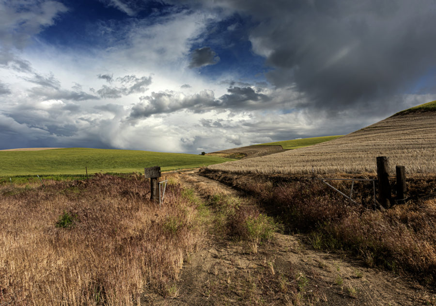
Featured Image: Farm Lane, Sherman County, Oregon
Camera: Nikon D810
Lens: 24-85mm Nikon-D
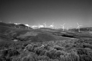
Looking Over Mosier from the HCRH Trail, Infrared
Camera: Nikon D300 (infrared conversion)
Lens: Vintage 20mm Nikkor.
Religion, Columbia Gorge Near Mosier
Camera: Nikon D300
Lens: 24-120mm NIkon VR
The Bridge of the Gods in Cascade Locks, Oregon
Camera: Nikon D810
Lens: Vintage 35mm Nikkor
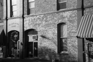
Hwy 30 and Orchards, Mosier, Oregon, January 2016
Camera: Speed Graphic 4×5
Lens: 90mm Nikkor
Film: Kodak T-Max 400 developed in Ilfotec HC
Memaloose Overlook, Columbia Gorge, Oregon
Camera: Nikon D300 (Infrared Conversion)
Lens: Vintage 20mm Nikkor
From the Memaloose Overlook, Mosier, Oregon
Camera: Nikon D300
Lens: 24-120mm Nikon VR
Sunrise from Rowena Crest, June 2016
Camera: Nikon D300
Lens: Vintage 20mm Nikkor
The Rowena Loops
Camera: Nikon D300
Lens: 24-120mm Nikon VR
Four images stitched together to create one
Autumn in Rowena, Oregon
Camera: Nikon D810
Lens: Vintage 50mm Nikkor
Overlooking Wishram, Washington, Spring 2017
Camera: Nikon D300
Lens: 24-120mm Nikon VR
Grain Elevator, Biggs Junction, Infrared
Camera: Hasselblad 500CM
Lens: 50mm Carl Zeiss
Film: Konica IR 750 developed in Clayton F76+
Near Horsethief Lake # 3
Camera: Speed Graphic 4×5
Lens: 8″ Cooke Anastigmat
Film: Kodak TXP 320 Developed in PMK Pyro.
Washington SR 14 after 2018 Grass Fires
Camera: Nikon D810
Lens: AF 50mm Nikon F1.8
Undulating Hills, Rowena, Oregon
Camera: Nikon D300
Lens: 24-120mm Nikon VR


