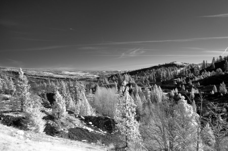
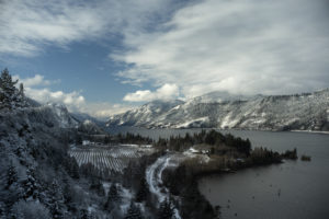
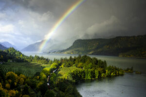
There is a tiny Columbia Gorge town about six miles east from Hood River, Oregon, that has become my favorite spot for photography, based mainly on the ruggedness of the scenery, and the bony white oaks that punctuate the landscape. Mosier extends its tendrils out well beyond its actual boarders, mainly due to the lack of another town nearby (don’t tell Ortley), and is (sort of) famous for fruit, specifically cherries and grapes. In the Spring, the hills erupt in white blossoms, and later beget wine and cider.

Mosier is the epicenter of some interesting geology. While I still haven’t figured out the difference between a Syncline and an anticline in real life, I understand the definition. There’s a fold in the Earth’s crust, the way up is a Syncline, and the way down is an anticline. In practice, it’s much harder to tell what’s what. The Mosier Syncline is a famous piece of geology, but some say that it is actually an anticline. I’m not the only one with this problem. While Mosier is almost at river level, steep hills rise on both sides. Hiking becomes a cardio workout even at slow speeds.
Mosier Creek is just to the east of town, and a trail leads from the HCRH along the creek past Mosier Creek Falls, and then zigzags up to the Mosier Plateau (get the idea that everything is named “Mosier” around there). The previous picture shows the way up to the Mosier Plateau.
Weather sets Mosier apart from the rest.
Mosier is in the “rainshadow,” which is a weather pattern created by the Cascade Mountain Range, and begins just east of Hood River. The moisture laden clouds that normally blanket Western Oregon with its fabled rainfall, and Seasonal Affective Disorder, run into the Cascades where they dump their wet cargo before dissipating on the eastern slopes. This effect is noticed more in the warmer months. During the winter, all bets are off.
Living in Hood River gave me an opportunity to see the rainshadow effect on a daily basis. A long hill on I-84 leads up to Hood River going East, and on the downhill slope, I often notice that the clouds have become sparse. The tall pines and the mossy limbs of cottonwood trees give way to white oak and grassy hills. There are still Ponderosa Pine and Douglas Fir, but they no longer dominate. On the Washington side, the town of Bingen already shows the signs of limited rainfall. The Oregon side changes more gradually, and retains some of the hallmarks of the wet side of the Gorge until Mosier, where it diminishes more noticeably eastward. Mosier, you could say, is at the sweet spot of the climate. It’s certainly on the dry side, but trees are more abundant.

The winter months near Mosier are windswept and cold. The bare, spindly oaks can be shaped by the wind, much like one sees at the Oregon Coast, where the trees lean away from the ocean as though fleeing for the safety of interior forests. There are days at Rowena Crest that that I can’t use a large format camera, or a brimmed hat, and that I have to weigh down my tripod, and strongly consider tying down the car.
The Historic Columbia River Highway (HCRH)

From downtown Mosier, the Historic Columbia River Highway heads east, and State Road goes southeast before turning into Seven Mile Hill Road. Hood River Road, and Proctor Road head west, but my main concern over the years has been the HCRH.
Mosier sits at the fulcrum of two segments of the Historic Columbia River Highway. The first, heading westward, is the Twin Tunnels Trail (look for a future post about it), and the second, heading east, becomes a drivable road that staggers about a varied and undulating landscape of white oak, grasses (golden except for winter and spring), and rocks freckled with lichen. This stretch of the old highway is perhaps my favorite, beating even Waterfall Central some 40 miles to the west. This road connects the wet side to the dry side. The trees here are shorter, and crotchety in their thirsty jaggedness. Early morning deer cross the road, or motionlessly watch the cars go by, always ready to put hoof to dirt should the need arise. Before long, the road reaches the high plateaus where the Balsamroot swaddles the nubile springtime with yellow, and Lupins bolt upright, clad in their majesty’s purple. It swoops down into a ravine, and then rises to the Tom McCall Preserve, but on the way it crosses the Dry Creek Canyon, which, as I mentioned before, was where I saw my first upside-down waterfall.
This brings us back to the subject of wind.

On a spring day in 2014, I drove up to the Crest with my wife, and we stopped just before arriving at one of the pull-offs next to the Dry Creek Canyon bridge. It was in early April, and rain had fallen that morning, I used exclusively film then, and I had my Hasselblad along. I also had a large format camera, but once I had the car door open, I knew I would not be able to use it. The wind was too intense. I put the ‘blad onto the tripod, but I could not let go of it for fear that the wind would blow it over. I soon felt a few drops of water on my face. I looked up, and there were no clouds. I decided not to use a light meter, once again, because I couldn’t let go of the tripod. I guessed at the exposure, and focused on an old barn across the ravine. I felt a few more drops of water. Then, I noticed a small rivulet of water running through a pipe under the road. From there, it ran down a short slope to the cliff on the near side of the canyon, and over the edge to become a little waterfall. The wind was blowing the waterfall back up the cliff, and onto the road, and me: an upside-down waterfall.
Whether traipsing through the wildflowers of the Tom McCall Preserve, ascending the switchback trail to the high perch to the south, or gaping out over the eastern Gorge from Rowena Crest, (seeing the young people with no grasp of mortality, or gravity, climbing over the stone barrier to stand on the precipice where a mere two feet of terra firma ward off splat), I find this stretch of the HCRH to be enthralling.
As mentioned before, State Road leads out of Mosier to the Southeast. I would not be doing the area justice without further exploration.
Hidden places: Finding the diamond in the rough.

State Road, leading southeast from Mosier, becomes Seven Mile Hill Road after a few miles. It climbs way up onto a windswept mountain that overlooks The Dalles, and is famous for its wildflowers in the spring. The road, of course, is named for the hill. I have explored this road and its gravel-clad tributaries off and on over the last few years looking for the BIG SHOT. I have discovered, however, that sweeping landscapes are difficult there due to the lay of the land and the lay of the road on the land. Add in electric poles and it becomes frustrating. But, I like the white oaks, so one day I set off with a photographer friend in search of them.
There is a road called Walker Farm Road that sets off from Seven Mile Hill Road straight toward what looks like a deep canyon. You can see the hills behind Mosier, and the horse pasture in the foreground, but there is a mysterious gap between the two that is cut off by “NO TRESPASSING” signs on the fences. Not being able to get to the canyon, we drove farther up the road. The summer day was hot, and the sun cast shadows through the trees as I saw a little dell, not quite a ravine, right next to the road. I parked, and we got out with cameras in hand.
Guitarist Carlos Santana famously said that the space between the notes was just as important as the notes themselves. Similarly, choosing what exclude from a picture makes what is included stand out. I had that in mind when I took the picture above.
State Road becomes Seven Mile Hill Road. Just before descending into The Dalles, the road emerges to a wide sweep of scenery. And, heading down into the Columbia Gorge, there are more views to be discovered, and, more importantly, places you can pull over to take pictures. Here’s one.

Even though I have moved back to the Portland area, I fully intend to be in Mosier, or its surroundings, as often as I can.


